Hidden Topsham – Part Four

A glimpse of the town from the higher part of the River Exe

Upriver – the other end of town

To round off my current series of blogs about Topsham, I’d like to take you on a wander heading out of town up the river Exe, towards Exeter.
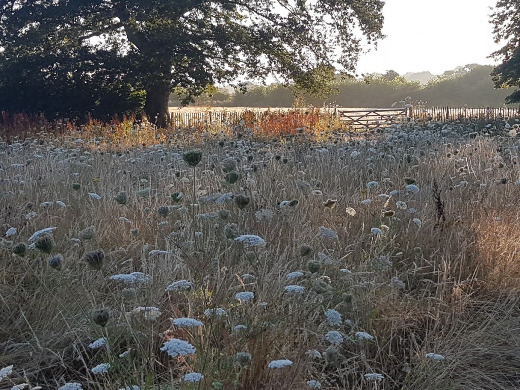
Sir Alex’s Walk
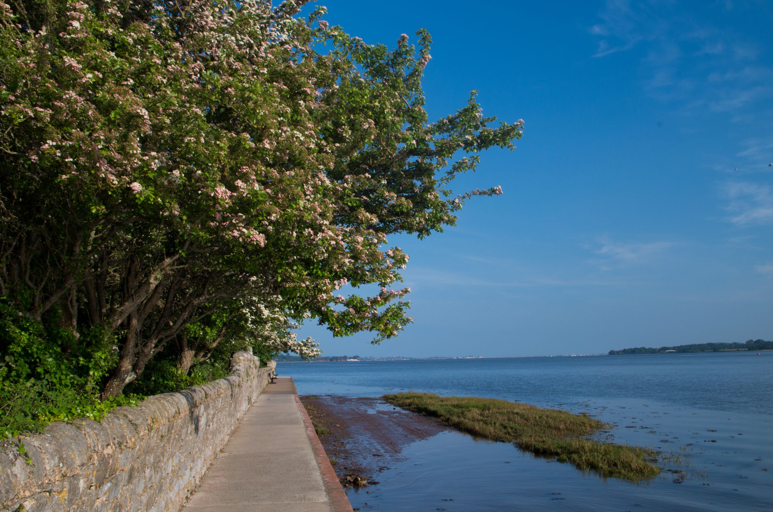
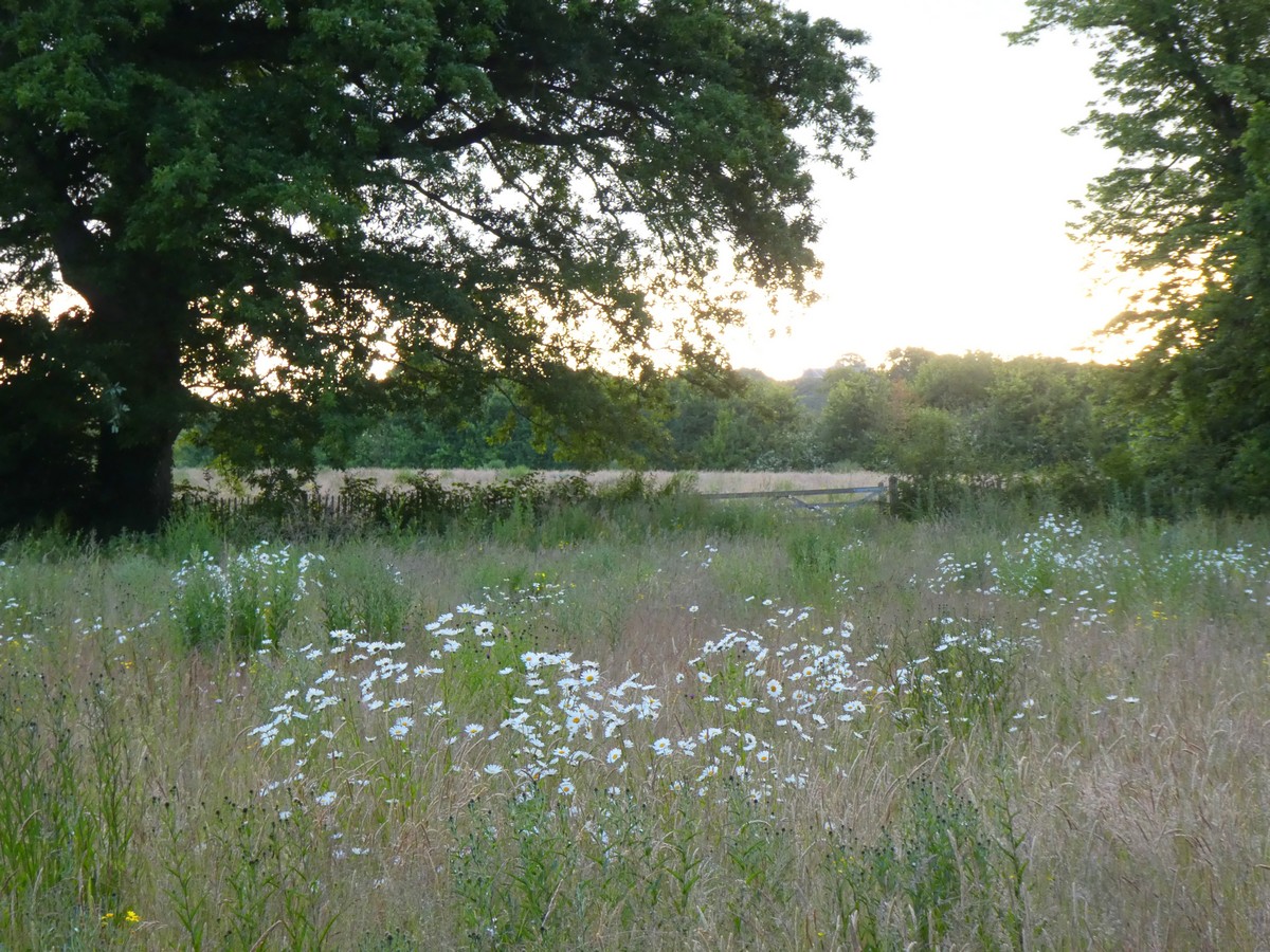
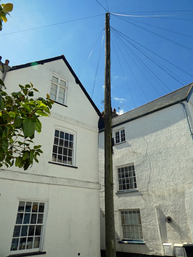
This riverside path is far less popular than the Goat Walk at the other end of Topsham. Perhaps the warning sign gives a clue as to why this should be.

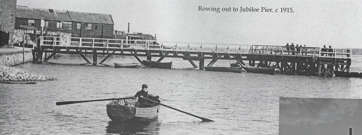
Apparently, this wasn’t always the case. Even as late as 1968, D.M.Bradbeer wrote, ‘This pretty riverside walk is much frequented on fine summer evenings, when it is pleasant to loiter on the bank and watch the fishermen at work with their nets, and the sailing boats criss-crossing on the tide’.

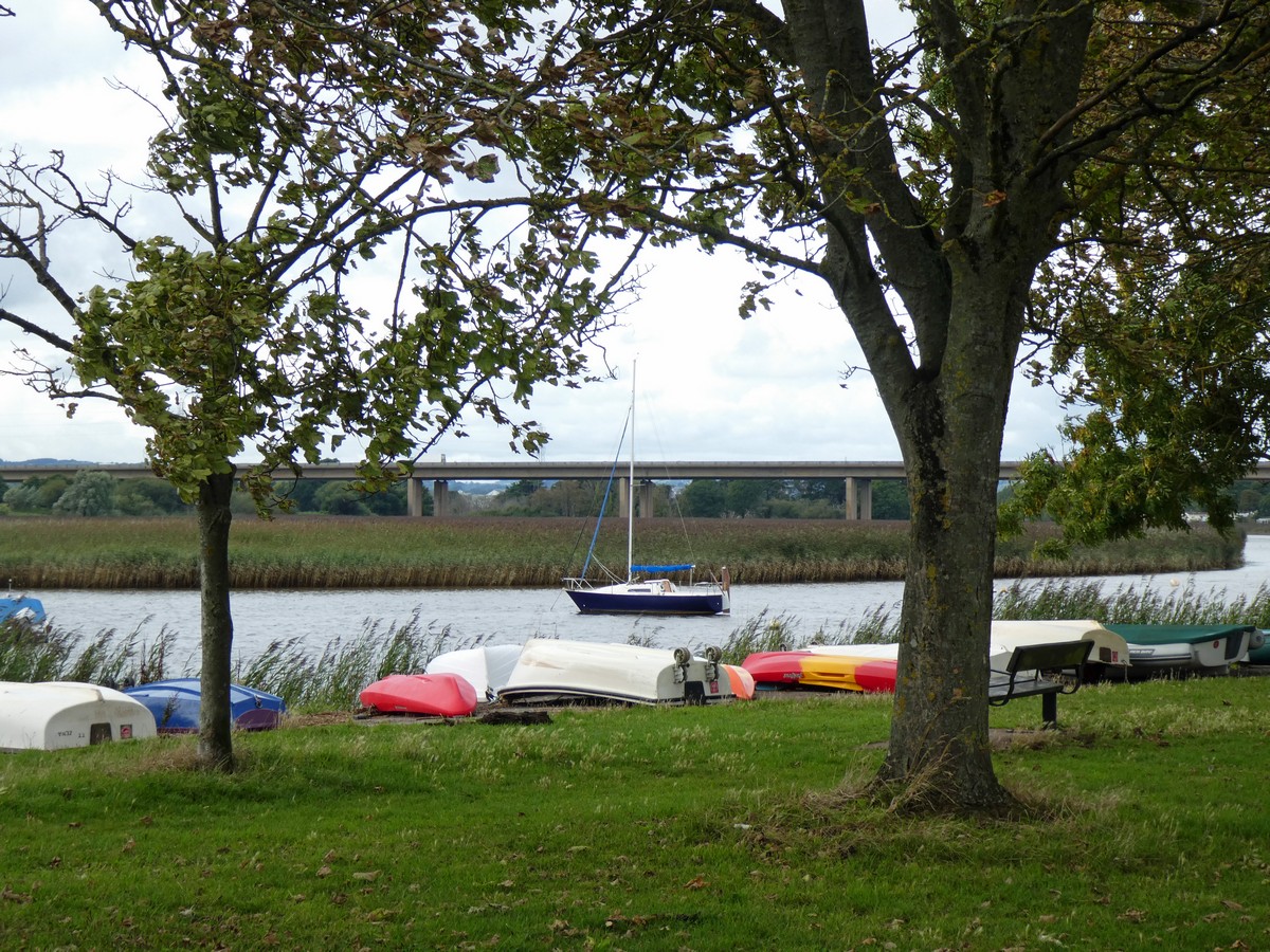
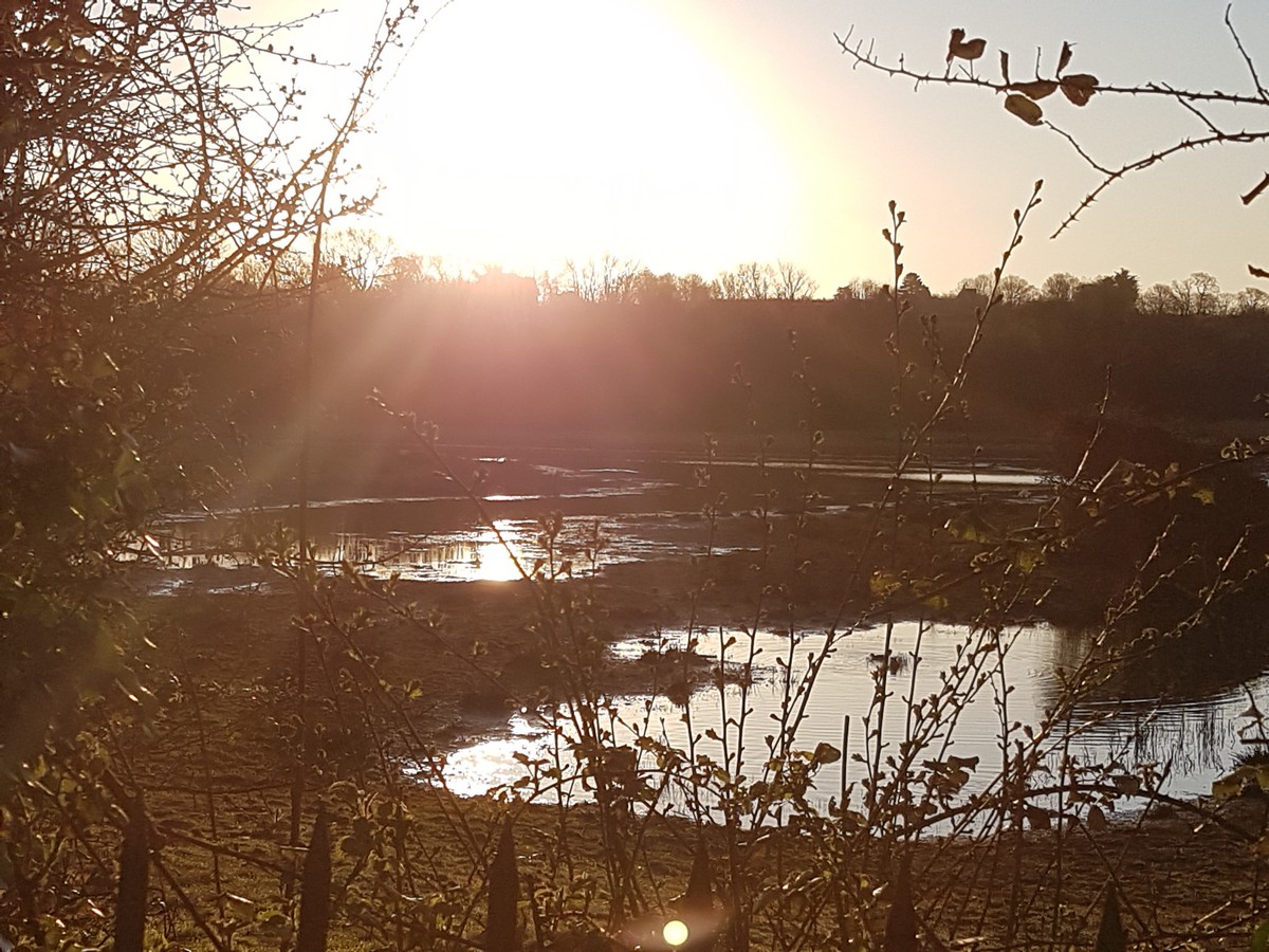
The vista from the path today, however, is slashed by the M5 motorway bridge, and the fishermen are gone. Seine net fishing (stretching a net across the river) is now illegal, and in any case the practice had dwindled to a final few licensed boats as the salmon stocks had all but disappeared in the last twenty years. But the river bends, beds of rushes, overgrown landing stages, muddy creeks and boats in all stages of repair give this stretch of water an eerie charm. Nevertheless, it’s hard to imagine how so many strollers ever did manage to walk along this narrow path, as it’s like navigating a narrow Devon lane where you need to keep an eye out for passing places.

Rats, robberies and the scenic route

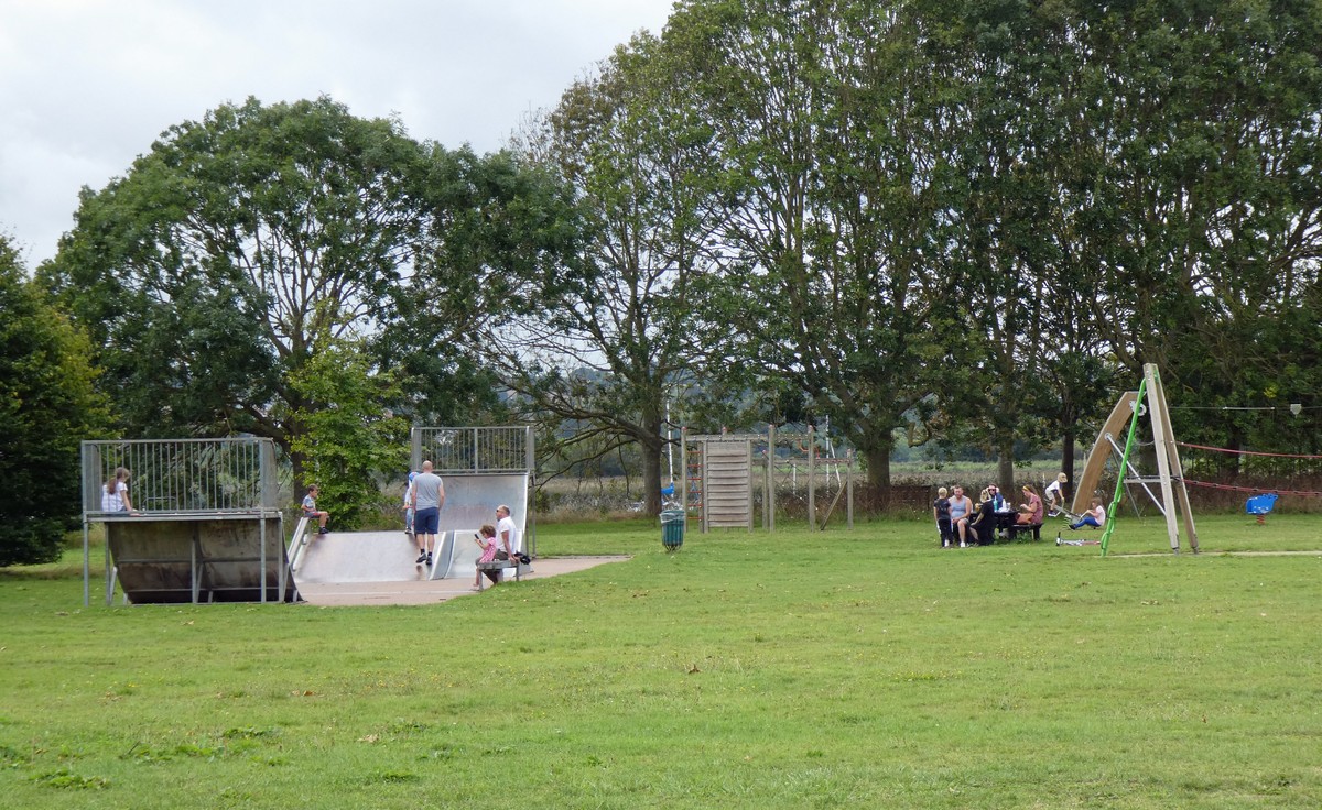
Before we get to the path though, the walk first takes us down Ferry Road, passing the Recreation Ground on the left hand-side. With its children’s playground and open grassy spaces, the ‘Rec’ is well-used in a town which doesn’t have all that much public land for community use, apart from the Goat Walk fields which I described earlier. The Rec might look rather flat and featureless, and that’s because it is largely an artificial plot, created on land reclaimed from the marshes. This happened over the years by very pragmatic means, since the site was used as the town rubbish tip.

In his memoir, John Willings (b.1923) recalls how in his boyhood the site was still evolving and was certainly what we’d consider hazardous today. At one end there were the Lime Kilns where ‘children used to play in and out of the caves which, even when empty, had plenty of lime dust on the walls and floor’.

Lime kilns on Ferry Road, opposite what was Heywood’s Dock. These may be the ones that John Willing refers to. From ‘Topsham: The Historic Port of Exeter’, Peter D. Thomas (Topsham Museum)
‘The Old Lime Kilns near Topsham on the Exe’, painted by John White Abbott 1808 . One of the sets of kilns around the town, suitable for an artist’s choice of backdrop.
Below is another similar type of work, ‘The Lime Kilns near Topsham on the Exe, Lympstone and Exmouth in the Distance’ by William Traies (1789–1872)

I searched for more information about Topsham Lime Kilns, and lime kilns in general. There were several sets of kilns around the town, where limestone was calcinated at high temperatures to produce quick lime. This was used for making cement, and as a soil improver in agriculture. Stone-built kilns left to fade into gentle ruins appealed to artists of the 19th century, as a romantic backdrop, as these paintings show.

But they could also be the scene of high drama. On Nov 27 1908, The Western Times reported that a daring robbery had taken place at the Topsham lime kilns situated near the River Clyst. A young man, named Leonard Johns, who was employed at the Odam’s Manure Works nearby, had just been to the bank, and was walking back with a bag containing £35 for the payment of the company’s weekly wages. ‘His assailant sprang upon him suddenly from tunnel in the old kilns, and, throwing a sack over his head, stole the bag and made off on a cycle towards St Mary. Our picture shows the boy Johns with the bag, and a well-known amateur actor who, to enable the scene to be reconstructed, impersonated the character. The masked robber is still at large.’ Does this grainy photo perhaps show one of the earliest ‘Crimewatch’ re-constructions? Later, the empty bag was found under the bridge at Winslade Park.

A photo from the article of 1908 in the Western Times, perhaps rather daring for its day, in asking an actor to play the part of the wicked thief. (Retrieved from the British Newspaper Archive)

Returning to the lime kilns at Ferry Road, these would certainly have been a potential health and safety hazard for the children who played in them, both because of any residual heat and the very real possibility of the lime dust irritating or even burning the skin. The Wikipedia article which cites this risk also contains the surprising information that we may be eating it in our bread and cakes: ‘It is known as a food additive…as an acidity regulator, a flour treatment agent and as a leavener. It has E number E529.’

If Topsham children of the 1920s and 30s survived their encounter with the lime kilns, they could skip a little further along a rough track, (now the continuation of Ferry Road) to watch Mr. Punch Miller driving his horse and cart full of rubbish down to the tip several times a day, fulfilling his role as town dustman, and little by little building up the land which would become the playground of their future grandchildren.

In John Willing’s day, it was still very much a work in progress. Sport and rodents flourished together: ‘Enough of the wasteland at the “Rec” had been recovered, levelled and laid with turfs to provide a football pitch, which became waterlogged after every spring tide – and a part for swings and see-saws. Most of the area was still an ‘open’ dump where flocks of screeching gulls would pick at garbage and dozens of rats would scurry among the rusting tins and decaying waste. At one time the rats became so numerous that a hunt was organised which turned out to be a great sporting event for the town. The local fire brigade had been called in to pump water down the rat holes and flush out the rats who were than chased by packs of dogs and men and children armed with heavy sticks. Over 300 rats were killed…’

The path running along the river’s edge on the reclaimed land of the Recreation Ground today

At the end of the Rec and beyond what is now known as ‘the dog walking field’, Sir Alex’s Walk begins in earnest, winding its way past the gardens of the houses built on higher land in Riverside Road. This is where D. M. Bradbeer’s vision of a ‘pretty riverside walk’ begins to hold good.

The houses of Riverside Road, with an enviable view across the river

Again, John Willing lights up the less pretty realities when he recounts his cycle ride along the highest and narrowest section of the path. His father had given him a hand-me-down, heavy old bike, and John was determined to take it out on what was probably the most unsuitable track in the town for a trial run: ‘Being rather unsteady on my new acquisition I accidentally rode right over the edge and landed in the thick oozy mud – bike and all! I had to wade along the mud dragging my bike until the bank became low enough for me to clamber out. Covered from head to foot in the black stinking mud I dare not go back along the path where lots of people were taking their Sunday evening stroll…So I went on to the Newport fields and hid there until it became dark!’

The prevalence of mud, especially at low tide
Looking back towards the Lock Keeper’s Cottage, on the right. The river and the canal run in parallel down to Turf Locks about a mile further down

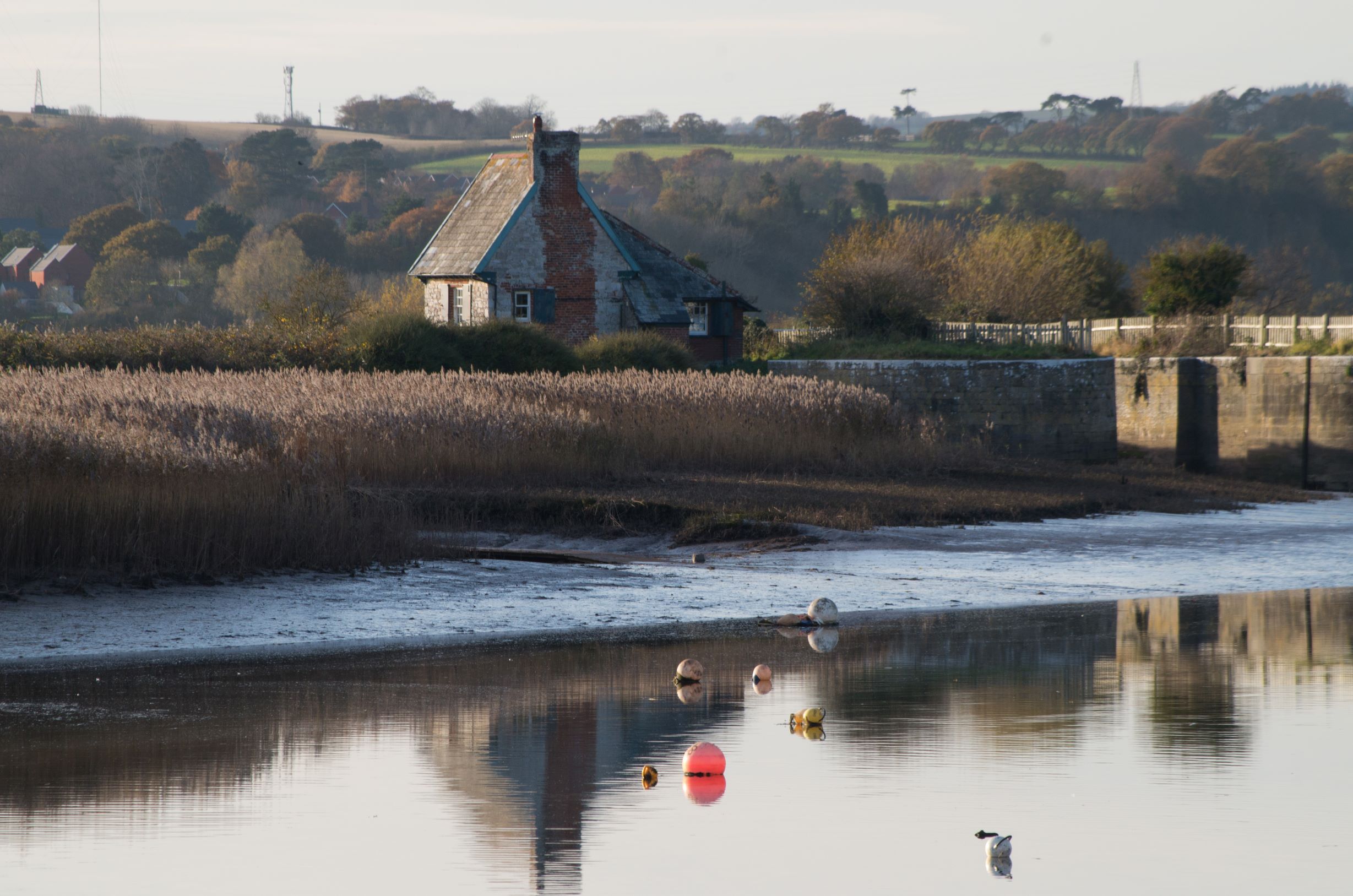
On the right Retreat House comes into view, a much more beautiful landmark than the motorway bridge which is now alarmingly close by. Retreat House is a grand mansion re-modelled in the early 1790s by Sir Alexander Hamilton, merchant and High Sheriff of Devon. Earlier in the 18th century, it had housed French prisoners taken in the Napoleonic Wars As you may guess, Sir Alex also gave his name to the walk. The name has been modified in popular use, and sometimes still appears on maps as ‘Serrallick’s Walk’. Sir Alex was apparently knighted simply for congratulating King George III on surviving an attack by a madwoman who tried to stab him.

The view of Retreat House from Sir Alex’s Walk. Apparently, it was intended that members of the public should be able to admire it as they passed.
The front facade, invisible from the riverside. (Estate Agency photograph)

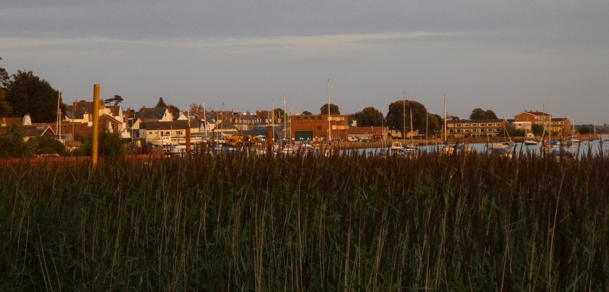
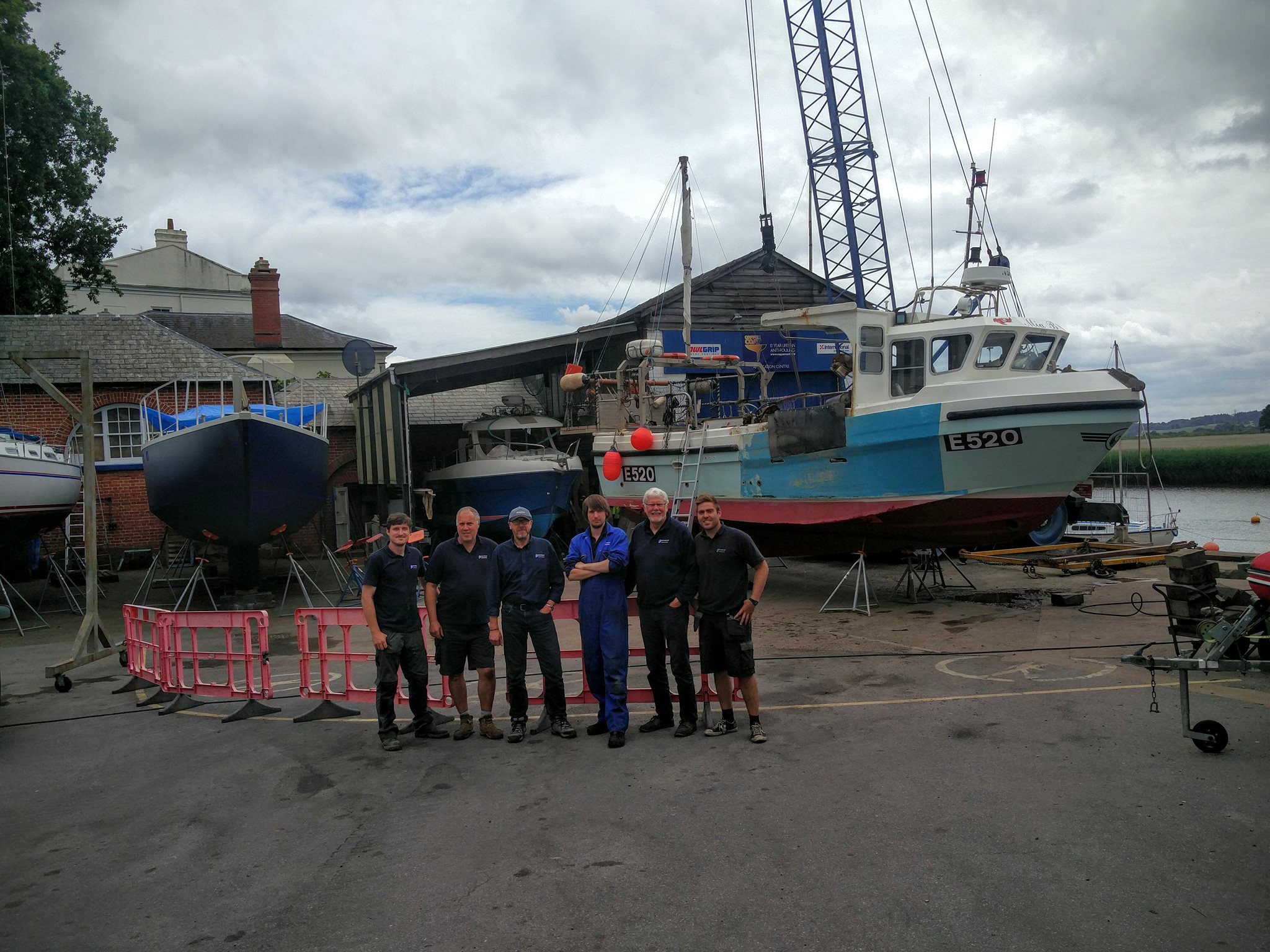
Beyond here, it looks at one point as though the path ends in a sharp drop, but when you get closer, if the tide is low enough, you see a set of steep, muddy steps leading down to a concrete path which continues forward, skirting the Retreat Boatyard. This is a fully working yard with expert boatbuilders.

And this is as far as I’m going up the river today, although you can continue beyond the bridge, skirting the Newport Homes site and heading…well I don’t know how much further! One day I will find out.

From the Facebook page of Retreat Boatyard

Names of the River

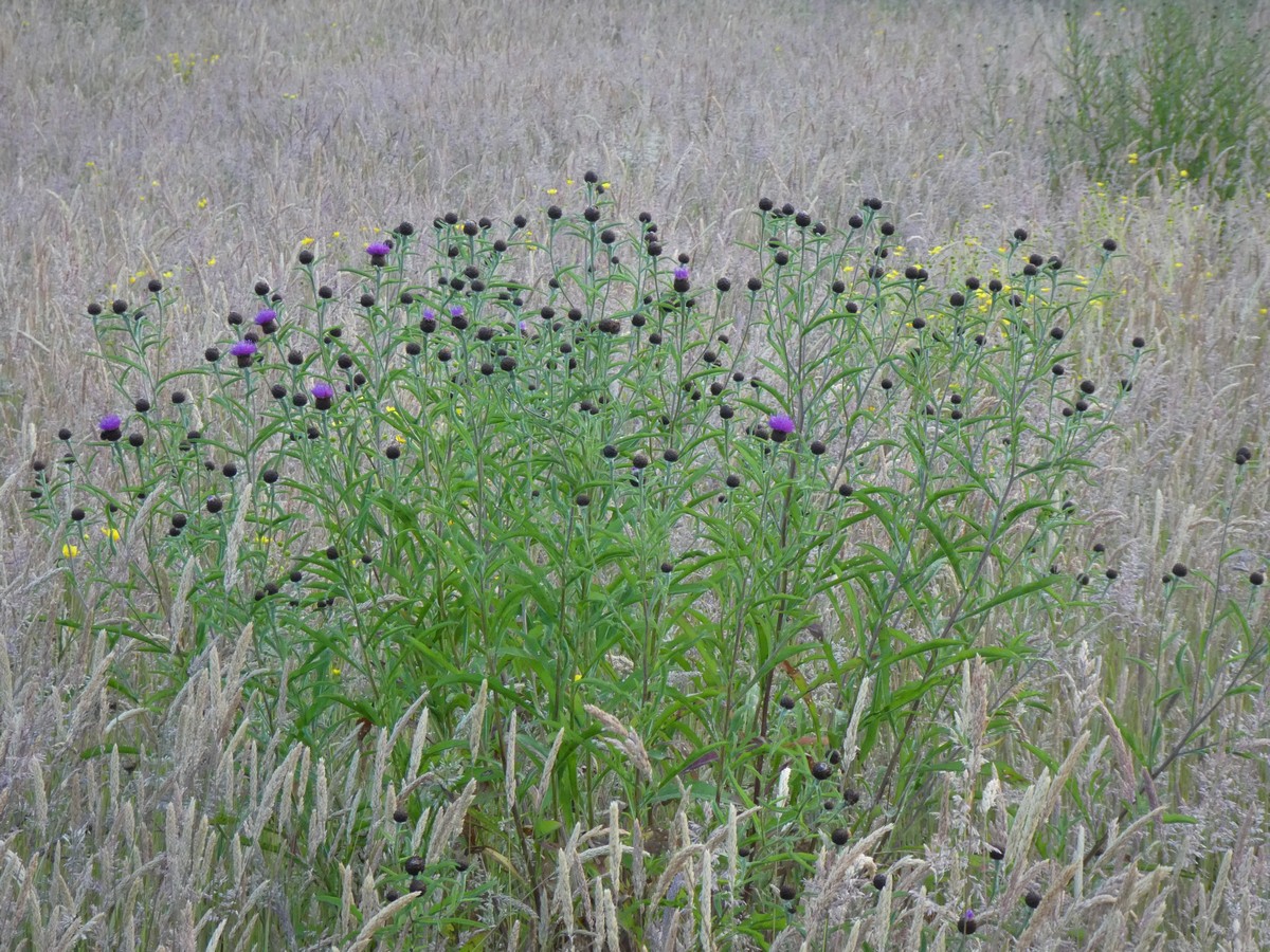
I’d like to end though with a mention of the old names for parts of the river, which have their own mystique. These were used not so long ago by the seine-net fishermen, as useful markers, guides to the spots to be fished: Clock, Black Oar Hard, The Drain, Cupboard, and Ting Tong, for instance, refer to places further downstream, but perhaps there are corresponding names for this upper stretch of river too? Please do leave a comment if you know of any!

I’d particularly love to know where the name ‘Ting Tong’ comes from. There are Inner and Outer Ting Tong Lanes a few miles away in Budleigh Salterton, but I’ve found little clue about their origin, apart from the fact that Ting Tong means ‘a little crazy’ in Thai. Wikipedia suggests: Possibly related to Thing (assembly)#Viking_and_medieval_society’. I can’t see an assembly being held in or on the far side of River Exe, but who knows? My Halliwell’s Dictionary of Archaic and Provincial Words (excellent for Call My Bluff party games!) is silent on ‘Ting Tong’, but does have ‘Ting Tang’ as meaning ‘the saints-bell’. The ferry from Topsham across the Exe used to carry monks heading from Sherbourne Abbey to Buckfast Abbey and points west in medieval times. Ting Tong lies on the opposite side of the river from Topsham, not too far from the present ferry dock, so perhaps the monastic travellers would ring the bell to alert the ferryman when they needed a return ride?

Looking south across the river from the present ferry crossing point

References

A History Little Known: A Topsham Childhood of Yesteryear John Willing (1984)

For details of Retreat House: Topsham: An Account of its Streets and Buildings, Caroline Obussier & contributors (The Topsham Society, revised edition 1986)

River names and map in Talking About Topsham, Stories of the Town Recorded by Sarah Vernon (2007)

Topsham Museum is closed until Spring 2021, but offers an excellent ‘Walking Trail’ map, which you can download here. The Museum is staffed by knowledgeable volunteers who may be able to help with individual enquiries too, about the history of the town and its families.

All photos except illustrations, or where stated, are by Cherry Gilchrist

You may also be interested to read:

The Tidal Town of Topsham

Hidden Topsham, Part One

Hidden Topsham, Part Two

Hidden Topsham, Part Three

Hidden Topsham – Part Three

This time, I’m going take us to some Topsham hot spots of hidden stories and unsolved puzzles, between the church and the riverside at Ferry Road. We’ll also meet two female saints who came to an unfortunate end, view some railings, and encounter some Topsham Cats.

Beast or Dragon?

The parish church of St Margaret’s set up high above the river’s edge has one of the best views in town, looking across the river to the Haldon Hills. It is dedicated to St Margaret of Antioch, which could indicate that the original donor had taken part in the Crusades, according to an archaeologist friend. The old Norman church was, however, largely demolished and rebuilt in the 1870s. A pamphlet circulated at the time offers compelling reasons in favour of this renovation, including: ‘Because it may improve the voice and lungs of the Vicar, and induce him to remain more at home and attend to the duties required of a Clergyman.’

The Font at St Margaret’s Church, Topsham, thought to be Norman, but could it be earlier?

But there is still one treasure inside the Church dating from early times – the ancient font. This has a mystery of its own: what are the symbols carved on it? Some say that they are a dragon and a moon, but ‘Historic England’ begs to differ slightly: ‘The Norman font has a circular bowl with big conical flutes, and on one side a large standing beast or dragon holding an apple (?) in its mouth.’ The question mark is theirs, not mine.

I put the question to the British Medieval History Facebook group, in 2018, along with a photo, and here are some highlights from the discussion that followed:

Debbie Worden
St Margaret of Antioch was supposed to have been swallowed by the devil in the shape of a dragon, wasn’t she? Thanks for the fab photo!

Cherry Gilchrist
Yes, you’re right – maybe it has something to do with Margaret’s ordeal by dragon-swallowing. Some nice images of her here.

Sara Bicknell
All of the images of St Margaret I can find show her coming out of the dragon, not going in. Unless, thinking on my feet, this is a lion….It’s got a mane…

Marcella Normanno
Poor dragon, he may not be the scariest or the most powerful, but fat… and a round object? Some people have no imagination.

Colin Torode put up a photo of the Topsham church seal, from the RAMM collection

The seal of St Margaret of Antioch, held at ‘RAMM’ Museum, Exeter


Colin wrote: ‘The seal of Topsham Church (in Exeter Museum) shows St Margaret of Antioch emerging from the Dragon. The dragon on the font is slightly strange, but it’s not that unusual to find dragons and other beasts on fonts – especially on early fonts. They could be telling a story or they might have an apotropaic function. It’s been noted that the area around fonts is often high in apotropaic marks, put there to ward off evil spirits. Fonts tended to be placed to the north of the church, near to the “devil’s door”, so it would be natural to decorate them with protective imagery.’

Susan Morrish
It looks slightly Viking influenced

Sara Bicknell
Further research dates the original church to Saxon times, I’m wondering if the carving might be preserved from even earlier. See, I looked up Norman lions (and dragons, I’m open minded) and it looks nothing like but it does have a chunky, late Saxon/Viking look about it, as I say. Please excuse my tenacity but I was an Anglo Saxon archaeological specialist in a previous existence.

Perhaps you might have something to add? Please submit your comments!

Samoa Terrace

Here’s an unassuming little plaque, placed almost out of view, high on a terrace of red-brick houses on Topsham’s High Street.

So how did this idyllic island, far away in the Pacific Ocean, give its name to a street in Topsham? The answer lies in guano, better known as bird poo! The terrace was built by John Potbury Cridland (1849-1930), who made his money by shipping tons of the ‘product’ from Samoa back to Britain.

Image of Samoa – where anthropologist Margaret Mead made a famous study of the love-life of the islanders, living in what seemed to be a peaceful and ideal community.

David Bewes, whose wife is a descendant of the Topsham Cridlands, tells the story of this man who had an unusual career:
John Potbury Cridland, (1849-1930) was born in Topsham. He started out as a mason, but then became a shipwright. However, in the 1871 census, he is listed as a ‘light keeper’ at Dungeness lighthouse in Kent, and is believed to have worked on a number of lighthouses before heading off to the islands of Samoa in the Pacific Ocean. Here he ran a guano business for some years, and also founded a Masonic Lodge. When he returned home, he started to build “Samoa Terrace” in Topsham. He had to stop building, though, when he ran out of money, so he returned to Samoa to generate more funds before returning to Topsham and finishing the terrace of about six houses.
(Email correspondence with Cherry Gilchrist)

Samoa Terrace, Topsham. The plaque naming the terrace is rarely spotted by passers-by

This article gives you the low-down on the properties of guano as a fertiliser, which was so prized that it went by the name “white gold.” In 1856, America even passed a law permitting itself to take over any unclaimed guano territory anywhere in the world. Who would have thought such a far away saga could have had a direct influence on the town of Topsham? Imports of guano were sometimes stored in warehouses in Topsham, which must have been a smelly business.

‘Johnny’ Cridland and the Goat Walk

John Potbury Cridland also wanted to re-shape the river foreshore at what is now the Goat Walk end of town. (Mentioned in Hidden Topsham Part Two.) ‘Mr Cridland’s Plan’ was for a four and a half acre recreational area, and he despised the alternative version of the raised river path, which we have today. He wrote indignantly to the Board of Trade in 1909:

‘The Shipbuilding trade having been destroyed here and there being no other works of any kind carried-on, the inhabitants are now trying to improve the town in order to attract visitors and to make it a residential centre.’ The plan for the path, he told, was absurd: ‘As a Freeholder and an inhabitant of Topsham I strongly object to this path being made. It would be an unsightly encumbrance on the foreshore and a laughing stock for all visitors to this town.’ (Letter in possession of David Bewes)

We can catch a glimpse of this plan in a photo from 1909, as a poster stuck up in a shop window. On it is written:
Mr Cridland’s Plan – The Improvement of Topsham – The rents of the Bowling Green Marshes will pay (for the) Improvement.

John Potbury Cridland is buried in Topsham Cemetery with other members of his family.

The Cridlands

John Potbury Cridland’s family has had a history of entrepreneurial development. When we moved into our house in Fore Street, we found this plaque propped against the ivy-covered garden wall, inscribed: ‘This part of Great Paradise rebuilt A. D. 1845 Richard Cridland’.

Richard Hunt Cridland (1788-1855) was John Potbury’s grandfather. He was born in Topsham as the illegitimate son of Elizabeth Cridland and (probably) Daniel Hunt. He was a mason, carpenter, joiner and also the parish sexton. He married Mary Wills and his own son Richard (one of their 11 children) became the father of John Potbury Cridland, of guano fame. Richard junior (John Potbury’s father) was also a stone mason and he became sexton in his turn, although there was a mild scandal when he took over the post:

Some excitement exists in our parish in consequence of the irregular appointment of the current sexton. It appears that Richard Cridland the elder vacated the office of sexton in 1838 and the church wardens and minister nominated and presented Richard Cridland the younger at the visitation – the appointment being vested in the parishioners by immemorial usage. This innovation having been discovered, the appointment has been set aside, and the election of sexton is fixed for Monday next, at 11 o’clock, there being two candidates for the office.
Western Times – Saturday 09 October 1841

However, to return to ‘Great Paradise’, Richard Hunt Cridland also built and bought up properties. Our house on Fore Street was one of them. It was originally a medieval cross-passage house, added to over the centuries and standing as one major dwelling until Cridland divided it up into three in 1845. They shaved off part of the magnificent Beer Stone fireplace (now in our sitting room) in order to squeeze in a central, tiny front door, which we’re tempted to nickname ‘The Needle’s Eye’. The name ‘Great Paradise’ (paradise originally means ‘garden’) may signify that the land was once held by an abbey, but we’ve yet to find any historical record of this.

Richard Hunt Cridland left a detailed and complex will in 1855, dividing up his property and cottages among family members. He also built workers’ cottages in Follett Road, then called Higher Passage.

‘A costly nest of vice’

Follett Road is our next stop. As our previous stroll down White Street showed, innocent exteriors may conceal notorius pasts. Here, the respectable white facades of Clara Place were intended to obliterate the traces of a far more disreputable building which once stood her. This was the town workhouse, institutions known mainly for their harsh treatment of paupers, but was condemned for immorality when its female inhabitants began to offer special services to to supplement their meagre means. It was described as ‘a costly nest of vice and dissipation’ by Robert Davy (Topsham: An Account of its Streets and Buildings). A local developer, William Clapp (an unfortunate name in the circumstances) finally pulled it down and rebuilt it, naming it ‘Clara Place’ after his most virtuous wife. Now it’s divided up, with charming cottages, with a central garden.

Jubilee Pier

Follow Follett Road down to Ferry Road, and turn left towards the Passage Inn and the Underway, where fishermen not so long ago hung their nets on the steep walls there to dry and be mended. The Underway today is a popular spot for people to sun themselves on the benches, picnic and even play chess.

Chess and a glass of wine on the Underway. Permission was kindly given by this couple for me to upload their photograph.

But there is also a small, sad feature which is partially hidden today. At low tide, stone footings are revealed in the mud.These are the remains of Jubilee Pier, a white painted wooden structure which was built in 1887 to celebrate Queen Victoria’s Golden Jubilee. However, its upkeep was neglected, and 1917 Tom Pym, a boy of 8, fell through some rotten boards and was drowned. The pier was pulled down shortly afterwards and never replaced.

Photos of Jubilee Pier, now completely destroyed

St Sidwell’s Railings

Back by the Passage Inn, near the ferry, you will see some handsome light blue iron railings, acting as the boundary of a riverside garden. For years, no one knew where these had come from. Now they’ve been traced St Sidwell’s Church in central Exeter, which was bombed into ruin in World War 2. According to Chips Barber, in Topsham Past and Present, these were ‘salvaged from the tip for a mere twenty pounds.’ You can see Sidwell’s initials ‘SS’ and a scythe pattern in the ironwork, shortly to be explained.

I knew nothing about Saint Sidwell(a), so I went into Exeter to find out more. Gary, a helpful manager at the St Sidwell’s café took me into the new Chapel, part of the modern St Sidwell’s Church and Community Centre. Here I marvelled at the bold modern window celebrating her life, and the two Victorian windows rescued from the bombing and beautifully restored. But who was Sidwell herself?

St Sidwell’s Church, Exeter: Victorian stained glass windows of St Sidwella, and the modern, large-scale chapel window celebrating her life

Sidwella (or Sativola) is Exeter’s very own saint. She too was beheaded like Margaret of Antioch who we met earlier. (Although Margaret came out of the dragon unharmed, her Roman captors still chopped her head off because she wouldn’t renounce her faith.) According to tradition, Sidwella was either Saxon or Celtic, living in the so-called ‘Dark Ages’ after the Romans had left Britain. The story goes that she was the daughter of a rich local landowner, with a jealous stepmother who was determined to prevent Sidwella inheriting the wealth which she planned would come to her own children. The stepmother bribed a reaper in the hayfield to behead the innocent girl, which he did with his scythe (hence the symbol in the railings). Immediately, a spring of pure water bubbled up where her head fell. The water was discovered to have healing properties, and the well built around it was considered sacred. A cult of St Sidwell thus emerged in Exeter, around the site of the current church and the well itself, as people came on pilgrimage from far and wide for healing and worship.

So where is the well? After a couple of false starts, my trail led to the Pura Vida Café in – yes, I should have guessed it! – Well Street, close to Sidwell Street itself. Clare, the mother of the young proprietor, explained that they have had to board the well over as it was making the room too damp, but showed me photos of how it had looked. It’s still preserved under the black and white chequered flooring.

Photos shown to me at Pura Vida Cafe of stages of uncovering and recovering the sacred well

And, as it turned out, Clare is a Topsham lady who used to run Pebble House Nursery where my granddaughter spent many happy hours, so we had plenty more to talk about! Maybe all such trails, even outside the town, lead back to Topsham?

The Civil War

Across the road from St Sidwell’s railings, there is a steep bluff, and the land above this is thought to have been the site for the garrison camp during the Civil War. Exeter was under siege, and fighting was fierce at times in Topsham, with canons and guns in use. Topsham was defended by the Royalists, but a couple of years later, Cromwell’s army placed garrisons in the neighbourhood, and its leader Sir Thomas Fairfax stayed for two weeks in Topsham. The site itself had probably been a look-out since at least as early as Roman times – the current owners of Eleanor’s Bower where it’s situated have found many shards of Roman pottery there.

View from the Civil War garrison and look-out post, now part of Eleanor’s Bower garden (private)
Where a quiet cup of coffee is now enjoyed , anxious military commanders once kept watch and even fired at the enemy. (Eleanor’s Bower, private garden)

Topsham Cats

I’ve ended previous Hidden Topsham posts with ‘Topsham Fancies’; now it’s the turn of ‘Topsham Cats’. Cats, after all, do hide away for much of the time when there are strangers around. Here are three associated with Follett and Ferry Road.

The black and white cat near ‘Furlong’ paused only long enough on the railings for me to take a photograph.

The grey cat in Clara Place, also hoping that the railings would act like stems of long grass to hide her, was especially shy. I photographed her because someone in Topsham was missing a grey cat, and I hoped to reunite them, but this cat turned out to be a legitimate resident of Clara Place.

Finally, there is Cosmo. Cosmo is a cat of character and might well be related to ‘Six Dinner Sid’ of picture book fame. Rumour has it that he was originally abandoned when someone moved house on the Strand. He is well-known for loitering around the Strand and Monmouth Street, where he has been kept in food by various kind people over the years. (He was occupying a seat in the Museum Garden the other evening.)

However, he has also been taken in by two separate households on Follett Road, after presenting himself as starving and homeless at their back doors. Each household in turn fed him, made him comfortable, and offered him a forever home. However, after a week or two, Cosmo tired of life at the northern end of town, and returned to loitering back down south again. While I was taking this photo in Monmouth St a couple of months ago, a gentleman opened the door, and I explained that I already knew a little about Cosmo. His benefactor rolled his eyes, and said, ‘Yes, he certainly knows where to come.’

Cosmo recognises me now and if he’s feeling sociable, he’ll graciously allow me to stroke him a little, before re-asserting his independence. How do you tell him from another black cat? You’ll know if it’s Cosmo once he raises his chin, and reveals the tell-tale little splash of white on his chest. He’s old and bony now, but is still able to dash into the bushes when he hears a bird flutter there.

Arch rivals in the back gardens of Fore Street and Follett Road – our own black cat Zaq in a stand-off with Spot (who has now moved to Sweden, I’ve been told).

This has been the longest of my Hidden Topsham posts, and to ease the length of these narratives back again, the next will be a shortish stroll upriver to Retreat House.

You might also be interested in these earlier blogs about Topsham – just click on the link to open them:

The Tidal Town of Topsham

Hidden Topsham Part One

Hidden Topsham Part Two

Hidden Topsham – Part Two

This is the second part of my search for obscure nooks and crannies of Topsham, and its hidden stories.

White Street

Dare you walk down White Street? The crooked entrance to the street looks inviting, but also a little spooky.

Head around the corner, however, and you’ll see charming rows of cottages, with little stirring except perhaps a neighbourhood cat. But in the 19th and early 20th century, this was the Red Light district of Topsham – crowded, noisy and disreputable.  Even as late as the 1950s, young girls from other parts of town were forbidden to go there on their own. Fishing families had grown poor, and a mix of sailors of different nationalities coming ashore helped to fuel the frequent drunken fights, especially on Saturday nights.

You can still see the remains of the sign for the Malt Scoop pub, which finally closed in 1982 after complaints of rowdy motorbike gangs. It was also famous for its late night drinking sessions, since in about 1800 a secret door was installed leading into the neighbouring cottage. If the pub was raided, after-hours customers could then make their escape, and this seems to have continued as a very successful ruse for nearly 200 years.

All is changed now: today White Street is calm and quaint, and offers a very pleasant stroll through the historic heart of the town.

Topsham residents avoided walking up White Street, unless they had to pay their gas bill at the offices there, now a quiet residential enclave.
A current resident, enjoying the peaceful street.

Topsham Pubs

As a port, Topsham was naturally renowned for its pubs, and there were once over forty in the town. Only seven pubs remain now. Route Two Cafe was The Steam Packet pub within recent memory, which in earlier days was nicknamed ‘The Bucket of Blood’, since it had a reputation for fights and rowdiness! Trouble often broke out between sailors from different parts of the world and the locals – even those from Wales were considered ‘foreign’.

The memory of lost pubs sometimes lingers on in the house names, as here, with the King’s Head in Higher Shapter Street

But the Bridge, below, is still very much up and running today.

The Bridge is Topsham’s best-known and most historic pub. No one is exactly sure of its age; the current building incorporates 16th century elements, but an Inn has stood here since at least early medieval times, close to the important bridge over the Clyst River. This may have been where cargo loads of Beer Stone were landed by boat, for onward transport into Exeter, for the building of the Cathedral.

Did the stone for the fireplace in our house ‘fall off the back of a boat’ at The Bridge? The house is in Fore Street and was once the central section of a medieval hall house. It has one of only two Beer stone hearths in Topsham, according to the archaeologists, and dates probably from the late 16th century. Here it’s decked for Christmas.

The Bridge’s exterior hides a warren of charming snugs and a delightful old Malthouse, where folk concerts and story-telling sessions are often held.

A Royal Visit

Perhaps its proudest story in modern times is that of the Queen’s visit in 1998. It’s reputed to be the only pub HRH has ever stepped inside.

As this news report tells us: ‘Landlady Caroline Cheffers-Heard received a very confidential phone call from Buckingham Palace… “We were asked not to change anything so that was lovely because she wanted to see the inn as it was. Why she chose here will be a mystery forever…” The Queen was pictured at the 16th century Bridge Inn holding a bottle of special anniversary ale with Caroline and her father, Norman, in the background.

“She didn’t have a drink, but she did take away a case of out 101 celebratory ale.”’ I am proud to say that beer produced by my daughter and son-in-law’s brewery Powderkeg has also been on the Bridge bar list in recent times.

Come back, your Majesty, and sample it!

The hidden closet at the Salutation

Some Topsham pubs have particular features which only the keen-eyed may spot. The Salutation, for instance, which is now an upmarket hotel and restaurant, was once a coaching inn, hence the superb wooden doors which were big enough to throw open and admit the coach and its passengers. This in itself is not a surprise; however, the little white grill on the left may pose a puzzle. In fact, this was ventilation for a small mortuary, at the side of the coaching entrance. A body could be stored here in its coffin, and loaded discreetly onto a departing coach for burial elsewhere.

The Town Fields

After this time spent in pubs, it’s time for a breather in the beautiful community fields, six acres purchased in 2015 on behalf of the town by the Goat Walk Land Trust. These two fields, at the corner where the Goat Walk meets Bowling Green Lane, provide a secluded sanctuary for wildlife and indeed for visitors. Great care is going into the land management, which includes creating two seasonal ‘scrapes’ to help ‘improve drainage and habitat diversity’, as you can see here. Do consider supporting this excellent scheme!

It’s what I hope is the happy final chapter in the efforts to forestall unnecessary development in that area of Topsham. This tussle was around even when the Goat Walk was built in 1909 (see The Tidal Town of Topsham). Topsham developer Richard Cridland opposed its construction as he wanted to build over the whole foreshore of the river. In a pompous letter to the Board of Trade, he claimed that it was a ‘pettyfogging scheme’ which would be ‘a laughing stock for all visitors to the town’. Really?

I will have more to say about the Cridland family in a later blog, as they were also responsible for dividing up the house we live in, and for building Samoa Terrace.

During lockdown walks, I’ve sat in the Trust’s fields listening to birdsong, and marvelling at the early morning light on tall grasses, young trees freshly planted, and emerging wild flowers in the hedges.

Reka Dom

Take a walk back into town along the Strand, and marvel at Reka Dom, the white house with its intriguing towers (one of them built for water storage by an eccentric wine importer), and which at the end of May is adorned with elegant white wisteria. What are its other secrets?

Possibly, Peter the Great, who founded St Petersburg, stayed here when he came over to Britain from Russia to study boatbuilding from 1697-8. (He and his pals trashed their lodgings in Greenwich, so I pity their landlord in Topsham if he did park himself and his entourage on the Strand.) ‘Reka’ means river in Russian, and ‘Dom’ means house. As a somewhat lapsed Russian speaker, I checked with a Russian friend to see if the words did work this way to signify ‘River House’. (The language has complicated rules regarding adjectives placed with nouns.) She assured me that it’s fine.

So we are in with a chance for Peter the Great’s lodgings, and although this is an unproven story, the current owner told me that documents relating to Russian tenants in the house have been unearthed, although she doesn’t have the details. The house has been in her family for 80 years, and it was purchased when derelict in 1939 by her late father-in-law, architect Rex Gardner. As the war swiftly followed, he had to make do with whatever materials were to hand, in the fine old Topsham tradition of ‘making do’, including getting sand from the ’beach’ at the end of the Strand.

The Old Gaol, seen end on, with the former Steam Packet pub on the left. The quayside lies just to the right.

The Old Gaol
At the town end of the Strand, there is an attractive wedge-shaped building made of brick, now a home decor showroom. This has a hidden past however – it was once the town Gaol. One of its functions was to house prisoners who had been sentenced to transportation, keeping them locked up until they boarded the steamer which would take them to the convict ships that would then transport them to Australia or Tasmania.

The Seven Women Convicts – In a newspaper report of 1837, I found the story of seven women who were sentenced at the Devon Assizes to be transported from Topsham to Tasmania. They would probably have been lodged in the town gaol until the ship was ready to sail.

On Saturday last, Mary Dolbear, and Sarah Bartlett, each transported for 14 years; Elizabeth Ware, Jane Duffy, Susan Featherstone, Ann Rawlings, and Elizabeth Jones, transported for 7 years each, were removed from the Devon County Gaol to the Zephyr steamer at Topsham, order to be conveyed to the Platina, in the Thames, bound for Van Diemen’s Land. (The Western Times, Saturday 15 April,1837)

What were the shocking crimes of these women, that they should be sent into exile? Another newspaper reports further on three of them:
Susan Featherstone stole a shawl from Henry Liscombe of Stoke Damarel
Mary Dolbear stole a pair of boots from Peggy Hawkins
Jane Duffy (sic) a blanket and coverlet from John Greve at East Stonehouse
(North Devon Journal, Thursday 12 January 1837)

The Zephyr steam ship, pictured off Topsham by local artist Edward Henry Hurdle, from around the same period as the transportation of the seven women

It is shocking indeed that these women, aged 18 – 56, who were perhaps living in poverty, should be transported for such petty offences. The first part of their journey was by the regular steamer to London: ‘The Zephyr steam packet sailed every Saturday from Topsham to London, a journey that took three days, with stops in Cowes and Portsmouth’, according to Route Two Café, which was formerly the Steam Packet Inn which stood just across the street from the gaol.

Then the women were moved to the Platina convict ship . The ship’s records do indeed list the names of our seven women, among 113 female convicts, whose journey lasted from 22nd April, 1837, to 22nd October, 1837 when they arrived at Van Diemen’s Land, now known as Tasmania.

We know a little more about them from the medical records kept by the ship’s doctor on the Platina.
Jane Duffy (18) accidentally swallowed a pin which lodged in her gullet, and later suffered from dysentery.
Mary Dolbear (56) had dysentery twice, and also complained of rheumatism Elizabeth Rawlings (47) was another victim of dysentery

At least the doctor was conscientious and took trouble to write detailed case notes for some of the afflictions. On arrival, ‘female convicts arriving in Tasmania were housed at the Cascades Female Factory in Hobart where conditions were grim to say the least’. (note from Gill McLean of Topsham Museum)

The Old Gaol must hide many tragic and largely forgotten stories, ranging from drunken brawls to the last shivering hours spent before being sent away to the other side of the world.

Hidden Gardens

But I’d like to end on a more pleasant note. Topsham is a town of surprises, with hidden gardens and even small fields concealed behind town houses and up small lanes. Check out Topsham on Google Earth, and you will see how green it is. There are tempting gardens to be spied through gateways too as you walk around the town. Some lie directly by the river, often across the Strand from the houses they belong to.

Gardens along the Strand, often across the road from the houses.

And every two years, the Topsham Museum puts on a ‘Secret Gardens’ event, which is hugely popular as generous residents open up their plots for visitors to admire. Everyone wants to see what lies behind those garden doors, gates and archways! The next one will be in 2021.

Admiring the wildflower meadow at Eleanor’s Bower, during the 2018 Secret Gardens event. My granddaughter Martha wonders what she might find in the pond.

Below: Glimpses of the magical gardens at Wixels, a former coal store and now a beautifully styled home which extends into the river. (Visits courtesy of Mary Lambert). The mirrored view is from another ‘Secret Garden’

References: Topsham Inns Past and Present, Colin Piper (Topsham Museum publications, 2010) The Story of the Manor and Port of Topsham, D. M. Bradbeer, (Town & Country Press 1968) Topsham Past and Present, Chips Barber, (Obelisk, 2004)

A note from Cherry: I’m planning a ‘Hidden Topsham – Part Three’ for later in the summer. I hope that these intermittent blogs about Topsham will be of interest for our townspeople, for our sister town across the sea in Topsham Maine (who’ve expressed enthusiasm!) and for anyone else with a fondness for this unique place. Please subscribe to the blog, to receive notifications about the upcoming posts.

You might also be interested in:

Hidden Topsham – Part One

The Tidal Town of Topsham

Hidden Topsham

Hidden Topsham – Part One

‘If you walk’… This is the first part of a look at ‘Hidden Topsham’, and it’s a series of invitations for you to explore certain nooks and crannies of the town, both here through my post, or perhaps in person. One of the delights I’ve experienced from living in Topsham is the continual discovery of features and stories which are hidden from normal view, perhaps by the obscurity of their position, or their concealed history. Topsham is a town of unexpected twists and turns, as I’ll reveal later. But I’m going to start with two stories from the edge of the town.

The Mourne Lass in her current position on the River Clyst, near its meeting point with the River Exe on the edge of Topsham

The Mourne Lass

If you come from Darts Farm, just outside Topsham, and take the footpath a short way further towards the town on the left, it will take you through a little-known part of the Topsham area, passing some charming cottages, and then running along the back of Odhams Wharf and Tremletts Quay. Here, if you look towards the River Clyst, you’ll spy a dilapidated blue boat called ‘The Mourne Lass’. I had long wondered what her story was, and how she had got there, so I did some digging.

Mourne Lass in her sailing days

She has in fact a venerable history as one of the oldest fishing vessels in Brixham. It seems that she is probably about seventy years old; in an undated post, her owners in recent times ask for advice on restoring her, saying that  ‘The ‘Lass’ is a an ex-MFV, which we are working on in an attempt to give her a new lease of life in her retirement. We need to replace the 60 year old deck, but we can’t afford (time and money) to do this for a few years.’

Berthed at Topsham Quay a few years ago

For a spell, she was berthed at Topsham Quay, but now appears to be slumbering in the waters and mud of the Clyst. In her glory days, she continued to sail in Brixham even after she was decommissioned, and to take part in the famous Brixham Trawler Race. Watch her overtaking the competition in this YouTube clip from 1993! (NB – if your device doesn’t show the correct clip, please refresh the page, as there was a slight glitch earlier)

Tryphena Gale (‘Thomas Hardy stood here’)

If you stroll to the back edge of the Topsham cemetery, you will find the memorial to Tryphena Gale, 1851-1890. Tryphena was the wife of Charles Gale, the landlord of the South Western Tavern in Fore St (now the Co-Op, and formerly Drakes Inn). But she was born Tryphena Sparks, and was the beloved of Thomas Hardy, one of England’s most famous writers. They were probably engaged for a while, though the evidence isn’t clear. She was also a relation of his – the usual version is ‘cousin’, but some sources hint that she may in fact have been a niece, which would have meant that any relationship would have been forbidden. In the photo below, Hardy is aged sixteen, and Tryphena looks to be in her twenties.

Both went on to marry other people, though Tryphena first trained as a teacher and became headmistress of the Plymouth Day School before her wedding to Charles Gale. The couple must have been comfortably off, as they ran an antiques business next door to their tavern, and also owned The Steam Packet pub (now Route Two Café).

Thomas remained close to his former love, and was apparently devastated by her early death, caused by childbirth just before her thirty-ninth birthday. In a poem to mark her passing, he refers to her as ‘my lost prize’, and laments that:


Not a line of her writing have I,
Not a thread of her hair,
No mark of her late time as dame in her dwelling, whereby
I may picture her there.

(Thoughts Of Phena – At News Of Her Death)

She had become a woman of the town. As ‘Exeter Memories’ records: ‘Tryphena was well known in Topsham for working to improve the lot of local fishermen – at her funeral, her coffin was carried by some local fishermen to the graveside. Sometime after the funeral, Hardy cycled to Topsham with his brother Henry and visited the grave – he left a note on the grave saying “In loving memory – Tom Hardy”. He was not given a warm welcome when he called on Charlie Gale to pay his respects’

If you stand by her grave, you may like to remember: ‘Thomas Hardy was here too.’

The listed telegraph pole. How did they get it into place?

Twists and Turns

As a Topsham guide, I love to lead visitors into some of the little alleyways. Even locals aren’t always aware of their existence. If you enter the one known as Trees Court, which leads up the side of Lily Neal’s bookshop on Fore St, your sharp eyes might spot a date over the side door, and one of the various old pumps which are studded around the town, in the cobbled yard behind. But perhaps you wouldn’t immediately remark on the huge telegraph pole in the middle of this open yard, or realise that it’s a Grade Two listed monument. This was in fact the first telegraph pole in the town and through the little window seen on the bottom left, the post master or mistress used to deal with the business of sending telegrams from the town. No one is quite sure how they managed to bring such a tall pole into position, especially as it has an extra 8 meters sunk below ground!

The date above the side door of the bookshop, and a selection of Topsham pumps

If you follow the alley further, you will see two spic and span examples of old workers cottages, with their privies across the yard.

Workers’ cottages…and their outdoor toilets on the other side of the yard!

And then you come to what I call ‘the All and Everything’ wall on the lefthand side. If you look closely, you’ll see that it’s composed of Dartmoor granite, volcanic rock, Heavitree sandstone (frequently used in local buildings), and ‘buns’, the rounded boulders found on the Jurassic beaches of Budleigh Salterton and Sidmouth. Not to mention the old grindstone, as I assume it was. Topsham has always been a place of ‘make-do-and-mend’ which sometimes descends into ‘cobbled together’ tactics. When we renovated our house further down Fore St, although the original medieval walls were sturdy, the more recent bathroom wall turned out to be made of flimsy wooden packing cases! Times were hard in the town, when the fishing industry and market gardening declined in the late 19th and early 20th centuries.

Along this alleyway from Trees Court, you’ll also see examples of Dutch bricks. These are small, narrow bricks which were brought back as cargo or even ballast after Topsham merchant ships exported goods to Holland in the 17th and 18th centuries.
Less picturesque – Dissenters’ graves among the rubbish bins

Finally, just as you emerge on Victoria St, if you peer over the tall wall on the left hand side belonging to the Masonic Hall, you might be surprised. Here, among the dustbins, are the old Dissenter graves, where members of non-Conformist sects were buried at their old chapel.

Glimpses

If you walk a little downhill from the place of entry to Trees Court, you will come across Chapel Place on the left hand side of the road. The cobbled path ends with a glimpse of a pleasant-looking, substantial house facing you. The house to the right however, which is even more tucked away, was once a chapel, and later the ‘Cosy Cinema’. Then it became a Glove Factory, as the old sign commemorates. A few years ago, I met a builder in Exeter who was the son of the last glove manufacturers there; he remembered coming home after school to sit among the employees sewing, and play with the scraps of material on the workroom floor.

The Seven Stars

And if you look on the opposite side of the road, you will spy an almost hidden entrance to yet another passageway. Walk up here (it emerges in the churchyard), and see where the mysterious old sign of the Seven Stars Cider House still hangs. What is its story? The author of the excellent Topsham Inns does not know. But someone else has plumbed its secrets. Ray Girvan gives a fascinating – if tongue-in-cheek – account in his own blog ‘Ray’s Secret Topsham’.

Here’s what Ray has to say:

‘The churchyard of St Margaret’s has an intriguing feature, the Hamilton Tomb. This is the tomb of Alexander Edward (‘Ned’) Kelso Hamilton, the young archaeologist on whom Bram Stoker based the hero of his story, The Jewel of the Seven Stars [an archaeological horror story about Egyptian mummies]. Stoker’s title was inspired by the Seven Stars Cider House which can be seen in the small close at the other side of the churchyard (the same location was used in the filming of Cider House Rules).

OK, perhaps this might be stretching a point? But to end the first part of my ‘Hidden Topsham’ posts, I’d like to offer Ray’s solution to another mystery. If you listen to people talking around the town, why is it that some say Tops-ham, and others Top-sham? This has long been a contentious issue in the town, and no one seems to have a definitive or convincing answer. Once again, Ray puts us to rights, speaking first of the King’s Beam, which I featured in my post ‘The Tidal Town of Topsham’:

‘In the late 19th to early 20th century, a stylised depiction of the beam was used as a religious symbol by the Topsamite Reformed Brethren, a non-conformist sect who preached that Joseph of Arimathea had visited Topsham with the young Jesus. The sect is still technically banned by an emergency law passed in 1915 when its leader spoke out in favour of the Kaiser, but it still exists and members can be identified by their secret pronunciation of the town’s name as “Topsam”. It’s of related interest that Oscar Wilde stayed incognito at the quay, “posing as a Topsamite”, before sailing to exile in France.’

So, are you a member of this secret sect?

Next time, I plan to take you up the once wicked White Street, into some Secret Gardens, and to follow in the Queen’s footsteps, among other delights of Hidden Topsham. ‘If you want to…’ of course.

Hiding in the ‘special tree’ in St Margaret’s churchyard with my granddaughters

To finish with, here are a few Topsham Fancies – these are the kind of things you may spot if you let your eye wander to the rooftops, the walls, and the porches of the houses of Topsham.

References

Topsham Inns Past and Present, Colin Piper (Topsham Museum 2010)

Secret Topsham, a blog by the late Ray Girvan at jsbookreader.blogspot.com/2014/04/secret-topsham.html  

The Story of the Manor and Port of Topsham, D. M. Bradbeer, (Town & Country Press 1968)

Topsham Past and Present, Chips Barber, (Obelisk, 2004)

Topsham: An Account of its Streets and Buildings, Caroline Obussier (Chevron Press, 1986 revised edition)

Previous blogs you may also be interested in – The Tidal Town of Topsham

Related books by Cherry Gilchrist

These titles were written for schools use. Although they are not directly related to Topsham, they paint a picture of social history and life in Britain from World War One up to World War Two. See also: People at Work 1930s-1980s and Shops by Cherry Gilchrist, also published by Batsford Educational.

The Tidal Town of Topsham

The first of a series of walks through my home town of Topsham

Topsham and the River Exe

I live in the tidal town of Topsham in Devon. It’s an ancient trading port on the River Exe, lying in a strategic position between the open sea at Exmouth some five miles away, and the city of Exeter further inland. When the tide is in, the widest stretch of water you can see downriver is about one mile across. At low tide, it’s little more than a channel winding through vast acres of mud.

During the lockdown, I’ve been taking a daily walk around a two mile circuit, past the quayside, up the Strand where the merchants once lived, along the narrow riverside path known as the Goat Walk, around by the bird reserve at Bowling Green Marsh, then back down historic Monmouth St and home via the town centre. At this quiet hour of the very early morning, in the springtime, it has been a truly magical experience.

Let me confess something. I love passing on what I know, and what I have discovered. I also love local history and have read and studied enough to become one of the Town Guides, one of a team offering public walks throughout the summer months. Sadly, we can’t do so this year because of the pandemic. But perhaps on this blog I can show you a few walks around the town, and the stories that go with them. 

This is the first therefore in a series of posts dedicated to Topsham, the town and its history. The photos will mostly come from my morning walks, but I’ll pick a few that I’ve taken previously, to fill in any gaps.

‘Topsham-on-the-Mud’ is the town’s nickname, although the mud can be very beautiful too, in its own way. Mud football matches were once held here, and you can even see a Blue Peter video about it.

The Topsham ferry plies a summer and weekend trade to take walkers and cyclists across the river, to follow the path up to the pub Turf locks. In living memory, though, it was still a key means of transport for nurses to get over to Exminster for their shifts at the mental hospital there, and for Exminster residents to come to work in Topsham.

The stretch of river where the ferry crosses, and the Lock Keeper’s cottage on the other side. A canal runs parallel to the river here.
Presentation of a commemorative carving to Mike, the retiring Ferryman. It used to be a paid post but is now run by volunteers.

Many ships were built in Topsham over the centuries, and there’s still one boatyard left today, run by the appositely named Trout family. The old hull of the ship is said to be a relic, abandoned after the boat builder died tragically.

The abandoned boat

The Lighter Inn was once the Customs House on the quayside. Nowadays it’s a popular pub with plenty of outside tables, a good vantage point for watching morris-dancing displays, music bands and other outdoor festivals over the summer months. To one side is an aged Thames barge, of the kind that used to sail upriver to Topsham. It’s now being lovingly – and very slowly! – restored.

Sailors came to and from Topsham from countries across the globe, especially Holland, Spain, and Portugal – at some periods, you could apparently hear more Portuguese than English spoken in the town! From the end of the 17th century, Topsham fishermen sailed to Newfoundland, where they had a summer colony. They fished for cod, salted it, and often came home via the Mediterranean to sell it en route. Rewards could be high, but the risks were great.

Morris outside The Lighter, and a close-up of The King’s Beam, a rare example of this old Customs weighing device.

The Strand is worthy of a future post, when we walk this way again, but for now I’ll just point out the beautiful merchants’ houses dating from the 17th and 18th centuries. The Dutch-style gables were inspired by their frequent trips to Holland, and plenty of narrow Dutch-made bricks were used in the buildings. The town Museum is housed here in a merchant’s house.

When you reach the end of the Strand, you can be faced with either an eternity of water or a huge expanse of mud – the town is nicknamed ‘Topsham-on-the-Mud’. Where does water end and sky begin? Alternatively, how could a boat possibly still navigate the channel at low tide? The answer is: only until a certain point in the ebbing tide. The other town ferry which runs up to Turf Locks has a very strict timetable, and if you miss your boat back from the pub there, you could be in for several more rounds before it returns. Turf pub was where sea captains used to wait up until the tide was right for them to put to sea, and it’s said that upstairs, you can still see the graffiti which they idly scratched into the 18th century windowpanes.

High tide on the river. Where does the water end and the sky begin? The sea is a distant line on the horizon, with Exmouth on the left. The river is a mile across at its widest point.

For a while, we rented a flat along the Strand, and amused ourselves on summer evenings listening to the screech of brakes as visiting drivers suddenly realised that they were approaching a dead end, leading straight into the river!

Some road users only see how the road ends rather late…

Pedestrians have it a little easier, since there is a narrow path, built up the side of the river in 1911. It’s a useful route, since you can get around to the other side of the town this way. Previously, there was only a path along the shore at low tide. However, rather than being grateful for the new walkway, the locals complained it was ‘only wide enough for a bleddy goat’. Hence it’s known today as The Goat Walk. It’s still the scene of contested space as joggers try to overtake pedestrians, and cyclists defy the ban to ride down there. But it’s now a much-loved feature of the town.

The Goat Walk, famous for its narrowness. If you’re on the path itself, care is needed as it’s a perilous drop into mud or water below. At low tide, as here, you can walk along the shore.

Bowling Green Marsh is now a Nature Reserve, with a renowned and popular bird hide. In winter you can see large flocks of avocets (very elegant, like small black and white flamingos), hundreds of curlews and godwits, Brent geese, redshanks, wigeon and teal. Rarities appear, such as a spoonbill or a long-billed dowitcher. Little snipe like furry humbugs hide in the long grass; herons stalk the water, rows of egrets stand and contemplate life, and sometimes a marsh harrier or even a migrating osprey visits. This wonderful reserve has been created out of old marshland which lies along the banks of the River Clyst, which flows to meet the Exe at the top of the Goat Walk. Previously, it plainly had something to do with bowling, and definitely once contained the local football pitch. Less amusingly, it was also a hunting ground for those shooting ducks and wildfowl.  

Some of the pools at the Bowling Green Nature reserve, awakening in the early morning light.

The lane is bursting with song from the smaller birds – wrens, a chiff chaff, robins, doves and pigeons, a magpie, tits of all kinds, with percussion supplied by a woodpecker industriously pecking away at an old oak tree every morning. It’s time to go home for breakfast.

If you’re interested in tidal rivers, you might also like to read Ebb & Flow: Notes on the Tidal Thames

Local sites of interest include Topsham Museum ; Love Topsham ; and the Topsham Society